![]()
State of the Climate Report for 2017
Posted by Thersites on UTC 2018-03-28 10:23
On 27 March the Global Warming Policy Foundation (GWPF) published its annual State of the Climate 2017. Compiled by Emeritus Professor Ole Humlum of the University of Oslo it is scientifically reliable and untainted by rhetoric from either side of the climate debate.
Just in case you don't hang around climate websites we have reproduced below the ten points from the executive summary. We have added some emphasis to help the speed readers.
Warm, warmer, warmest
1. It is likely that 2017 was one of the warmest years, according to temperature records from the instrumental period (since about 1850). However, it was cooler than 2016.
Air temperature

2. At the end of 2017 the average global air temperature was dropping back towards the level characterising the years before the strong 2015–16 oceanographic El Niño episode. This underscores that the global surface temperature peak of 2015–16 was caused mainly by this Pacific oceanographic phenomenon. It also suggests that what has been termed ‘the temperature pause’, ‘hiatus’, or similar terms, may continue in years to come.
3. There still appears to be a systematic difference between average global air temperatures estimated by surface stations and by satellites. Especially since 2003, the average global temperature estimate derived from surface stations has steadily drifted away from the satellite based estimate in a warm direction.
4. The temperature variations recorded in the lowermost troposphere are generally reflected at higher altitudes also, and the overall temperature ‘pause’ since about year 2002 is recorded at all altitudes, including the tropopause and into the stratosphere above . In the stratosphere, however, the temperature pause had already begun by around 1995; that is, 5–7 years before a similar temperature pause began in the lower troposphere near the planet’s surface. The stratospheric temperature pause has now existed without interruption for about 23 years, with no explanation offered by the climatological community.
Sea temperature
5. The recent 2015–16 oceanographic El Niño episode is among the strongest since the beginning of the record in 1950. Considering the entire record, however, recent variations between El Niño and La Niña episodes are not unusual. In late 2017, a new cold La Niña episode appears to have begun to emerge. If this continues, it will influence global temperatures in 2018.
6. Since 2004, when the Argo buoys came into operation, the global oceans above 1900m depth have, on average, warmed somewhat. The maximum warming (between the surface and 120 m depth) mainly affects oceans near the Equator, where the incoming solar radiation is at its maximum. Net cooling since 2004 is pronounced for the North Atlantic.
Sea level

7. Data from tide gauges all over the world suggest that average global sea-level rise has been 1–1.5 mm/year, while the satellite-derived record suggests a rise of about 3.2 mm/year since 1992. There is still no widely accepted explanation for this marked difference.
Sea ice
8. Arctic and Antarctic sea ice extent since 1979 have exhibited opposite trends, decreasing and increasing, respectively. Superimposed on these overall trends, however, variations of shorter duration are also important to understand year-to-year variations. In the Arctic, a 5.3-year periodic variation is important, while for the Antarctic a variation of about 4.5 years’ duration is important. Both of these variations reached their minima simultaneously in 2016, which explains the minimum in global sea ice extent. A shift towards larger ice extents in both hemispheres may have begun in 2017 (Figure 34), as predicted in ‘State of the Climate 2016’.
Snow
9. The Northern Hemisphere snow cover extent has undergone important local and regional variations from year to year. The overall tendency since 1972, however, is towards overall stable snow extent conditions.
Extreme weather
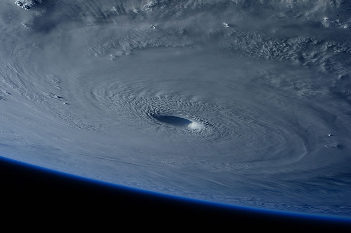
10. Tropical storm and hurricane accumulated cyclone energy (ACE) values since 1970 have displayed large variations from year to year, but no overall trend towards either lower or higher activity . The 2017 global tropical storm and hurricane ACE was above the level recorded for 2016 but was within the range experienced since 1970.
0 Comments UTC Loaded:
Input rules for comments: No HTML, no images. Comments can be nested to a depth of eight. Surround a long quotation with curly braces: {blockquote}. Well-formed URLs will be rendered as links automatically. Do not click on links unless you are confident that they are safe. You have been warned!